The Future of Toronto’s Stroads: An Intro
One of the Strong Towns movement’s greatest successes may be the popularization of the term stroad. This term has become increasingly widespread as urbanism and the adoption of good placemaking practices have taken on growing relevance across the world. Before digging into the state of Toronto’s stroads, it’s important to understand what they are.
A port-manteau of the words street and road, the term stroad was coined by Charles Marohn back in 2011. It refers to a hybrid of two different types of surface infrastructure that serve radically different purposes. On the one hand you have roads, which are intended to rapidly move people between places, and on the other you have streets, platforms for creating community and wealth. You could say that well designed roads easily get us to destinations, while well designed streets easily support destinations. Based on this, stroads are surface infrastructure which attempt to be both transportation corridors and destinations at the same time.
The purest expression of a road would be an expressway, areas dedicated to moving automobiles quickly and safely. In Toronto, the obvious examples would include sprawling and expensive feats of engineering like the Gardiner, the Don Valley Parkway (DVP), Queen Elizabeth Way (QEW). If you’ve seen the 401, then you’re familiar with the largest road in Canada and arguably the world.
Streets are much more local affairs. An illustrative example would be Tank House Lane in Toronto’s pedestrian friendly Distillery District. A former industrial neighbourhood, the area was redeveloped in the 21st century to accommodate an array of commercial and residential uses. Tank House Lane sits at the heart of this redevelopment, and, when you’re there, it’s obvious that this is a space dedicated to folks who want to stick around rather than quickly pass through.
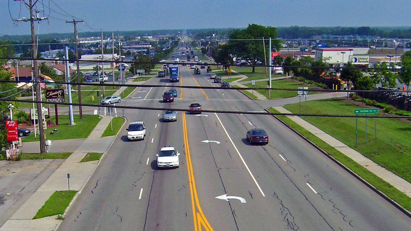
Stroads attempt, and arguably fail, to deliver the easy travel of a road with the versatility of a street. If you grew up in suburban Ontario, you can probably think of a despondent stroad where multiple lanes of relatively slow vehicle traffic stream by a gas station, some fast food restaurants with drive-throughs, and perhaps some big box retailers and car dealerships. Designed to be all things to all people, stroads are jacks-of-all-trades and masters of none. You won’t move as fast as you could on a road, and you won’t be able to do as much as you could on a street.
A great example in Etobicoke would be the stretch of Dundas between the Six-Point Interchange and the 427. Just walk along this stretch and you’ll quickly see the tension this hybrid design can create. Wide lanes of disruptive vehicle traffic exist alongside numerous local businesses and homes. Slated for extensive redevelopment and population growth, this stroad looks like it will become more congested and dangerous as more people and businesses come to call it home.
Moving from the world of Strong Towns to that of local transportation policy, Toronto’s stroads are generally classified as minor arterials and major arterials. In the words of our city’s classification system, which was recently updated in 2025, these public spaces attempt to balance “traffic movement” and “property access”. Translated for those not familiar with our local dialect of municipalese, these public spaces are meant for both passing through and stopping by. Essentially a 1 to 1 match with the Strong Towns stroad.
Keeping this all in mind, you now have the tools needed to think about how our stroads serve us today and how we can fix them.